Page 1 of 3
West Coast
Posted: Mon Dec 01, 2008 7:10 am
by S Allen
Place for folks on the west coast to put their favorite roads.
Re: West Coast
Posted: Mon Dec 01, 2008 11:03 am
by Linda
California:
Hwy 1- at Big Sur (central coast)
Stunt Rd- at Mulholland Hwy, Calabasas
Linda
Re: West Coast
Posted: Mon Dec 01, 2008 4:25 pm
by shifty
Northern California - Sonoma County
Stewarts Point - Skaggs Springs Road from Lake Sonoma to the coast.
One of my favorite drives - it's a bit a of a haul from San Francisco and back in a day, but it is worth it. Once you get past Lake Sonoma the road is wide and really well banked. Eventually it's not much more than a paved goat path. Great twisties, and great scenery!
http://maps.google.com/maps?f=d&saddr=3 ... 13861&z=11" onclick="window.open(this.href);return false;" onclick="window.open(this.href);return false;"
Re: West Coast
Posted: Mon Dec 01, 2008 5:29 pm
by S Allen
Northern California - Sonoma County
Stewarts Point - Skaggs Springs Road from Lake Sonoma to the coast.
That was one of my favorite roads and was in my backyard. There are quite a few good twisty Datsun Sports roads in Sonoma County.
Steve
Re: West Coast
Posted: Wed Dec 03, 2008 8:36 pm
by Minh
Sacramento County - Scott Road if you want to get your Roadster airborn. This 2-lane 2-mile stretch of country road has 4-5 whoopdy-doos and a number of hairpin turns that will leaves your kids asking to turn around and do it a gain. It is knw to flood a little during the rainy months.
The fun begins southbound from White Rock Road until it ends on Latrobe Road.
Enjoy! (I do at every chance)
Re: West Coast
Posted: Mon Dec 08, 2008 10:50 pm
by Alvin
The West Coast's Dragon!
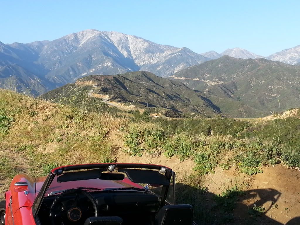
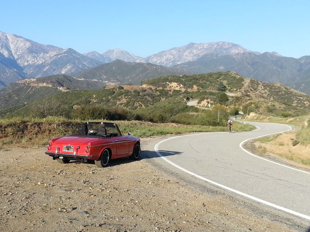
HW 130 or more commonly known as Mt. Hamilton Road to Lick Observatory.
Start from the Bay Area/Alum Rock Rd stop at the observatory and head down the backside to Livermore.
First of all its about 63.5 Miles Long. Secondly you have over 4200 Feet of Elevation Change. And to sum it all up you have over 600 curves.


Re: West Coast
Posted: Tue Dec 09, 2008 12:11 am
by waggleboy
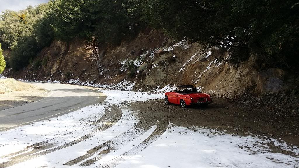
Chinook Pass, WA......Enumclaw to the top and back again.....not for the faint of heart
the map don't do it justice.....Altitude-750ft to 5,000ft plus on the top...Lk Tipsoo for lunch and down we go.
the downhill cruise is so relaxing......gotta stop for a cool one
Re: West Coast
Posted: Sat Dec 13, 2008 12:03 pm
by todd lorber
Alvin,
That road looks awesome. That first road sign you posted is similar to one I have been meaning to shoot a picture of in my area to use as my avatar. "Next 16 miles" looks like an adult Disneyland. The scenery back there reminded me of my Berkeley days when we would drive our 1200's through Tilden Park and the hills behind.
Re: West Coast
Posted: Thu Jun 25, 2009 2:38 pm
by todd lorber
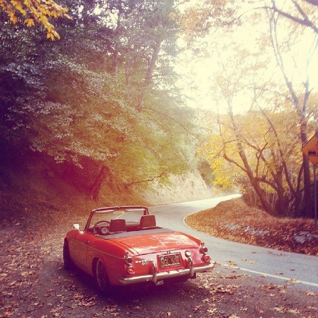
When I went up to Solvang a couple months back, I went through Ojai. Took the 150 down the hill and merged onto the 192. This was a great road with a lot of sweeping 90 degree turns. It runs through orange orchards, past some great houses (mansions) on huge land parcels. I gotta say, even the mini van moms were punching it on this road.
Stay on the 192 past the 154 and you will hit N. San Marcos Road. This is a great run with a lot of twists and topography that untimately hits the 154. Soon after the merge there is a nice shunt called Stagecoach road. The road was a little choppy but great for driving. This will then reconnect with the 154 and take you to Solvang from the east side.
Looking forward to it next year, if not sooner.
Re: West Coast
Posted: Mon Oct 31, 2011 2:43 pm
by dld
Hwy 49 from Coulterville to Mariposa. Lots of twistys, not much traffic. At the base of the Sierra Nevadas, mid state.
DLD
Re: West Coast
Posted: Mon Oct 08, 2012 12:45 pm
by mraitch
Oatman Highway from/to I40 to Needles - nice twisties - lovely scenery - get to Oatman at high noon (at least on the sunday we were there) and you get to see a shoot-out
Re: West Coast
Posted: Mon Oct 08, 2012 5:57 pm
by 68DSU
dld wrote:Hwy 49 from Coulterville to Mariposa. Lots of twistys, not much traffic. At the base of the Sierra Nevadas, mid state.
DLD
Hyw 49 from Placerville to Sonora. Twisty on the north end and long curves on the south end. Overnight in Columbia and ask the Rangers if you can park in their lot.
Re: West Coast
Posted: Sun Mar 24, 2013 11:43 am
by Linda
Colusa and Napa counties via hwy 20 at Williams to 53 to 29 thru Calistoga and on to Hwy 128 the Silverado Trail, or continuing 29 down the center of the Napa Valley. Very scenic
Re: West Coast
Posted: Sun Mar 24, 2013 11:58 am
by spl310
Looks like a trip down under to me....
Re: West Coast
Posted: Mon Mar 10, 2014 1:51 pm
by RCMike